Project Description
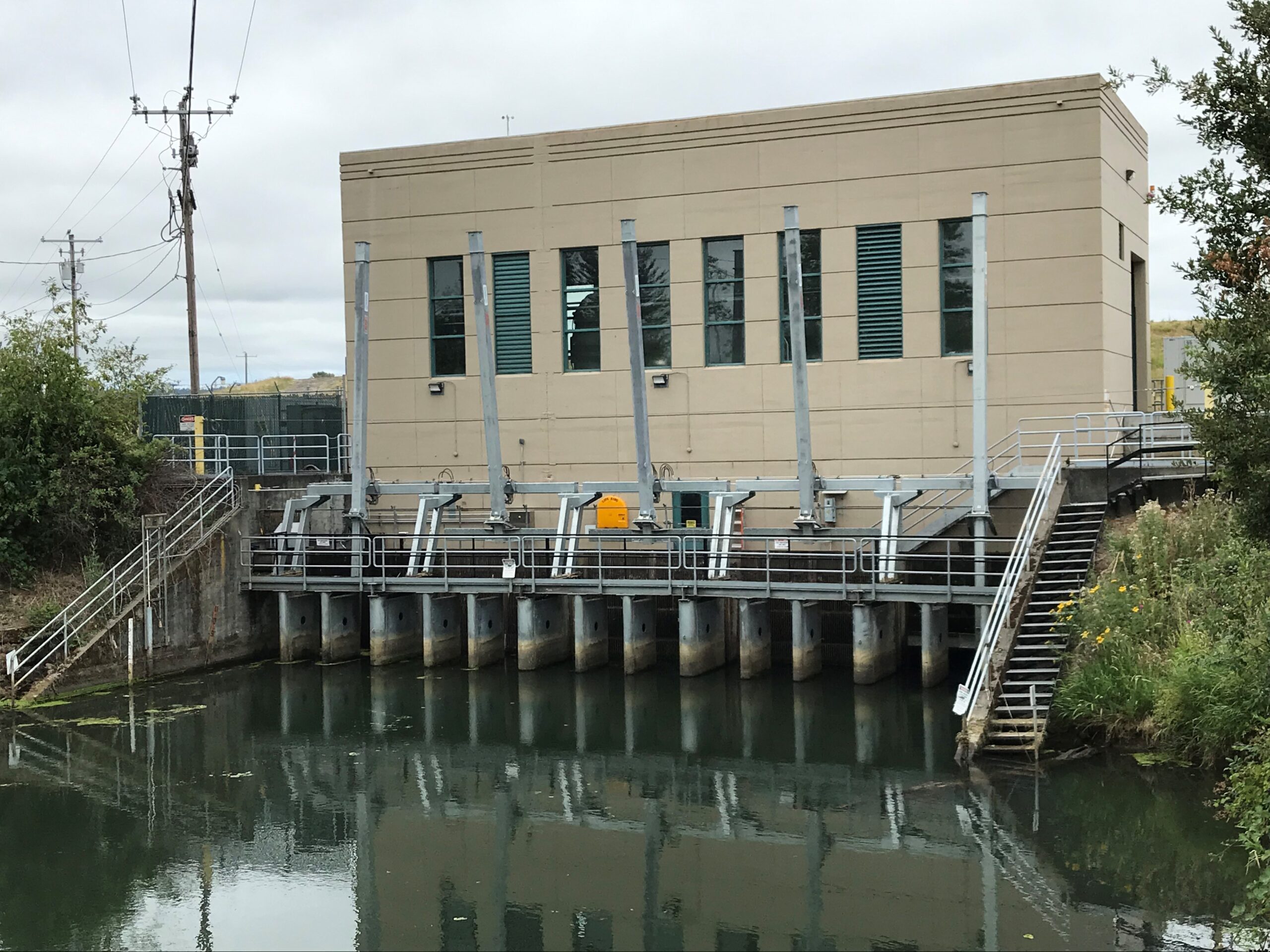
MCDD’s Pump Station 1 (PS1), built in 1949, is located within the managed floodplain along the Columbia River and Columbia Slough. This pump station plays a critical role as a part of the region’s network of levees, pump stations, and other flood safety infrastructure as it reduces flood risk by removing stormwater from Multnomah County Drainage District’s 8,590 acres, which includes a mix of industrial, commercial, and industrial areas within Portland, Fairview, and Gresham, and protects key public facilities like the Portland International Airport and the City of Portland’s supplemental water supply at the Columbia South Shore Well Field. Without this pump station operating, many low-lying areas along the Columbia River would be inundated seasonally.
Due to the age and location of the pump station, it was anticipated that the pump station would be quite vulnerable in a major seismic event like the predicted Cascadia Subduction Zone (CSZ) earthquake.
To help better understand the seismic risk at PS1, MCDD sought and was awarded a Cooperating Technical Partners grant from FEMA Region X in July 2020 to perform a seismic stability analysis. PS1 was selected by MCDD for this initial seismic analysis because of the vital infrastructure it helps to protect.
Project Findings
In collaboration with FEMA, MCDD worked with a local geotechnical and structural consultant to perform a seismic evaluation of PS1. Consultants reviewed geotechnical data from a levee certification study performed in 2017 and structural data from 1948, when the pump station was originally built. A special site inspection of the pump station was also performed by the structural engineer.
For the most part, this study provides us with some good news: structurally, the pump station is seismically sound and does not appear to require seismic retrofitting. Although the pump station is likely to settle and shift during a significant seismic event, the structure itself is likely to remain intact. That said, the structure’s connections to its foundation and the outgoing pipelines are likely to be damaged. As such, the results from this seismic evaluation have been incorporated into MCDD’s emergency plans in order to get the pump station up and running as quickly as possible in the event of an emergency.
The study also identified multiple options to improve seismic performance of the foundation soils and lists recommended additional evaluations that would allow for more accurate estimates of settlement, lateral spreading, and appropriate foundation improvement. After receiving feedback from the MCDD board and other stakeholders, staff will propose a set of next steps to better understand, and possibly mitigate, other seismic impacts on PS1.
Benefit
Better understand seismic risk and impacts on flooding, identify and prioritize mitigation options, and understand planning level costs for mitigation to inform how best to reduce risks to District landowners of pump station failure caused by a large earthquake.
Have questions? Want to stay up to date on this project?
Please contact Kevin Severson at kseverson@mcdd.org to be added to the stakeholder list for this project or if you have any questions.


No Comments
Sorry, the comment form is closed at this time.